Sumburgh Head, Puffin Contest, and Jarlshof
Views from the southern tip of Shetland
We’ll start with good news! Last week, I mentioned that when we were in Shetland during the first week of October, there was no Wednesday session at The Lounge Bar in Lerwick, a place where sessions have happened for over 60 years, featuring all the best musicians as well as lots of regular folk who simply like to play. The next day, we were told that the Lounge closed permanently on Sept 30.
But all is not lost — this past week, the news came out that a new buyer has purchased The Lounge and is planning to fix it up and restart the music sessions in November. Hurrah!
Today, we’re going to visit the southernmost point of Shetland, an area called Sumburgh, where we’ll see the lighthouse, the wildness of the sea striking the high cliffs, and if we’re lucky, some puffins.
On the way there, we stopped at the home and studio of a great violin maker, Ewen Thomson, who also plays fiddle and guitar in the band Haltadans. I mentioned them last week because we saw them perform during Wool Week. Fiddler Maurice Henderson has come up several times in my discussions because he was kind enough to join us on a number of our trips to play tunes, and tell stories about them. Of course, there have been loads of great fiddlers in Shetland, some of the most famous being Tom Anderson, Aly Bain, Willie Hunter, Kevin Henderson, and Chris Stout, plus many up and coming and older players whose names and influences are well known within Shetland circles.
Most Shetland tunes have stories behind them, some about boats and sailing, some about places, some about the trows, the magical little people who, at dusk in the mists, may very well entice you to play fiddle for them to dance all night. But that night with the trows might last 100 years of human nights and you won’t know the difference until you come out again and see that your own world has moved on a century. (I hate when that happens.) Maurice tells many captivating tales between energetic fiddle tunes, and you can find some great samples on YouTube if you like!
Below is a photo at Ewen’s house of music we were lucky enough to enjoy with our small group of travelers, and a photo at right from another time when just Maurice and Ewen played for us at a different house.
On our journey south we passed many small settlements, and at one point, had to wait at a stoplight for an airplane to go by — the main road crosses a runway at the Sumburgh airport!
When we reached the southern tip of Shetland and parked at Sumburgh Head, the scenery was dramatic as we walked up the road toward the lighthouse at the top. Sir Walter Scott wrote, “The breeze, contending with the tide, flings the breakers in great style upon the high broken cliffs of Sumburgh Head.” Below you can see these stylish breakers beating up the rocks, even on a relatively calm day.
The photo at right shows a mother kittiwake and her fuzzy gray chick that we spotted nesting in a nook among the cliffs.
In visiting Sumburgh, we hoped we might see puffins, but you never know for sure until you get there whether it’s nesting time for them. Puffins spend their lives out at sea, and come on land only to hatch their eggs and look after their chicks.
It was a delight to discover them when we did, and to carefully peek over the edge at them, try to get photos, and not scare them off.
Below are some shots I took of individual puffins. Please vote for your favorite!
Here are some groups shots. Can you provide captions for any of them? (Remember, if you’re viewing this on an email, you can click on the photo, and it will take you to the online version of this post, where you can zoom in on the pictures.)
When we got to the top of the road, we found a cafe with an amazing view, and a visitor center with displays about the building of the lighthouse in 1821, its use during World War 2, a chart of seabirds spotted in recent days, and info about the marine life and geology of the area.
Speaking of geology, the details of how the rocks of Shetland were formed are fascinating. I mentioned in an earlier article that one type of rock stretches under the sea from Sumburgh to Orkney and beyond, to include some of the northern coast of Scotland east of Inverness. This formation of rock has a telltale geological signature that has allowed researchers to determine recently that the giant altar stone at Stonehenge in southern England was transported from this area in northern Scotland (most likely from Orkney).
The geology of Shetland is so diverse that it was designated a UNESCO Global Geopark. These geoparks are determined to have “internationally significant geological features and landscapes,” and are “managed responsibly for tourism, conservation, and education.” Geoparks also integrate geology with “other aspects of heritage, such as archaeology, history, and biodiversity, all of which are intricately linked to the ground beneath our feet.” This designation for Shetland was recently approved for another four-year period beginning January 1, 2024.
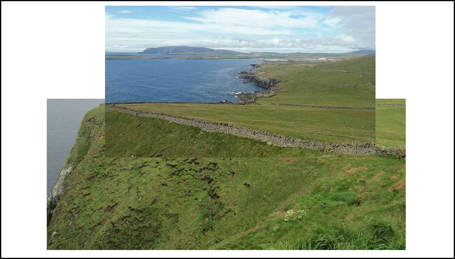
A little ways down the road from the lighthouse is an unobtrusive gate that Dorothy showed us. Below is a view south from there. I like the top picture but I blended it with the lower picture from another year (and another kind of weather), because it shows you the precipitous cliff at the bottom.
We walked first toward the right and followed the coastline all the way down along the green grasses and over the stiles at the stonewalls to reach the archaeological site of Jarlshof, which you can just make out in the distance, around the second bend.
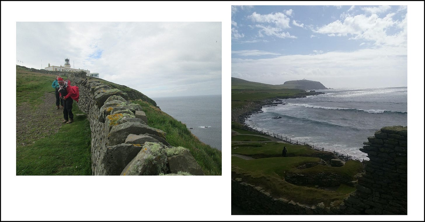
Below are two views looking back at Sumburgh Head during our walk down to Jarlshof. The first is partway down, and you can easily see the lighthoue at the top. The second picture is almost all the way down, but if you look closely, you can still see the lighthouse sticking up from the middle of the lump of land (Sumburgh Head) in the center back of the photo.
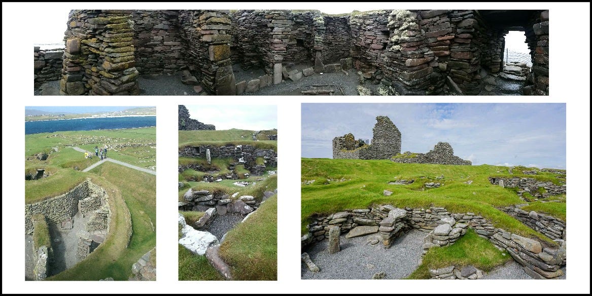
Jarlshof itself is a treasury of archaeological finds, with 4700-year-old Neolithic homes and continuous human constructions following that, including an Iron Age broch (large stone living quarters and defensive structure) from about 2000 years ago, wheelhouses from about 1400 years ago, Viking longhouses from about 1000 years ago (these constructions could be from 50 to 250 feet long), and a huge stone laird’s house built in the 16th century.
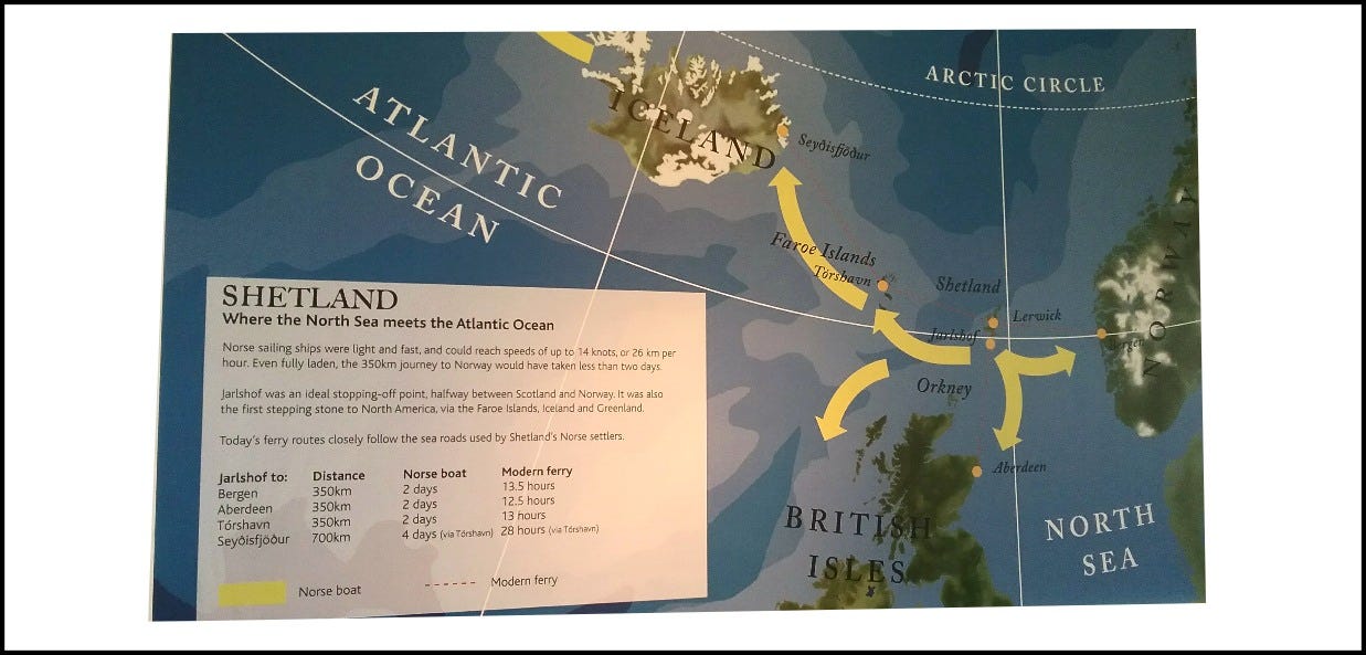
Below is a chart I photographed from the Jarlshof visitor center. I showed you this once before during our discussion of Orkney. It illustrates how Viking ships could easily sail 2 days from Norway to Shetland, another 2 days to either Aberdeen or to the Faroe Islands. From the Faroes, they could sail 2 days to Iceland, and from the other side of Iceland, it was a 2-day sail to Greenland. From the west side of Greenland, it was yet another 2-day sail to North America — an easy trip for Viking ships to manage, centuries before Columbus. This chart helps us visualize why Shetland and Orkney were something of a central hub for sea travel in ancient times, and why they have had so much sophisticated human settlement during the millennia since the last Ice Age.
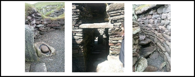
I find the Neolithic settlements captivating because when you see their slate bedroom walls, stone hearths, stone shelving, little stone cradles, storage rooms, and passageways, you can really imagine people living there.
Below are the ruins of a wheelhouse, so named because many rooms are built in a circular formation, separated by stone walls like the spokes of a wheel, allowing for the construction of a large building supporting a single roof.
In the last two photos you can see, in the rear, the gigantic ruin of a 16th-century laird’s house.
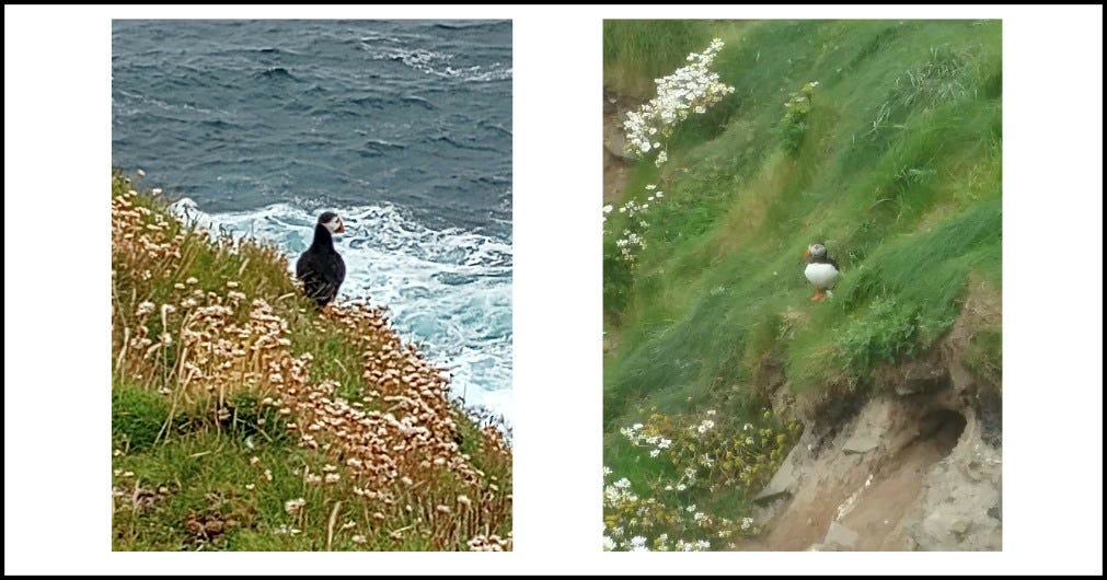
I’ll leave you with a few extra photos of puffins, one looking out to sea, and the other standing near some convenient sand tunnels that serve as safe nests for the little ones. What do you think these guys were thinking in these moments…?


Very interesting article 👍I am from the other side of the world. Where I live and surf and play the violin, The landscape is much the same, but there is no archeological sites. The landscape here was created by the European settlers cutting down all the trees for farming. I’m wondering if that’s what happened there at the Shetland Islands.
✨🌿☀️